
Resources & Guidance for Completion in the IB Geography Internal Assessment Requirements.
River Investigation
Aim: To investigate changes in the channel shape & size, bedload type, shape & size, river gradient, water velocity & discharge of the river Naranjo as it moves towards its mouth. |
||||
 |
||||
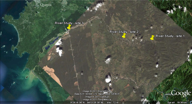
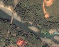
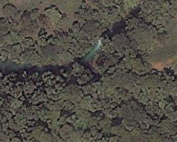
Satellite image of the Rio Naranjo - Costa Rica |
||||
|
||||
 |
||||
 |
 |
|||
| River Study: Student booklet | ||||
IntroductionSuggested question & hypothesis 1 Q: How do the River Naranjos physical characteristics change as it momves downstream? H: The bedload of the River Naranjo decreases in size and becomes more rounded with distance from the source. |
||||
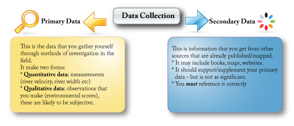
MethodologyDescribe each method you used (equipement, units of measurement, number of times repeated etc). Explain each of the methods you used (why you did it), what was the purpose. Random/ systematic sampling? Quantative/ qualatative data collection? |
||||
Data Presentation |
||||
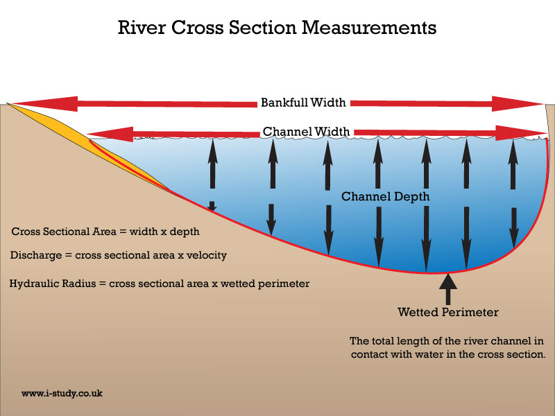
Cross section Using the measurements for width & depth you should be able to construct a cross sectional diagram on graph paper. If you want to use Excel - here is the instruction sheet. Make sure you use the same scale for all 3 graphs to allow comparison. Include: title, legends, units of measurement, site location. |
||||
| Annotated Photographs & field sketches - theese can be used to identify features of the river channel & changes in it at different sites | ||||
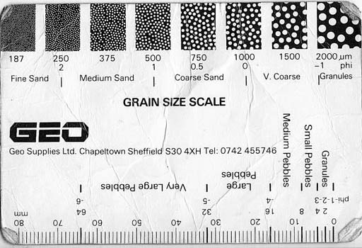
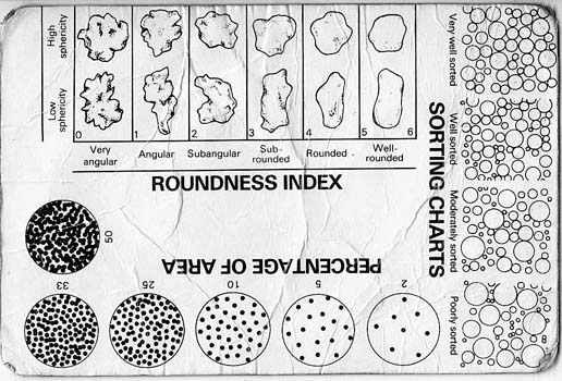
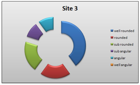
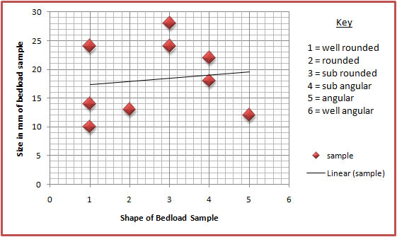
Bedload sampling - could be done as a compound bar chart & then put onto a map to show differences at the sites. Statistical analysis - relationship between the bedload shape & the size (the bigger the more angular?). Spearman Rank?
|
||||

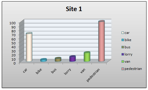
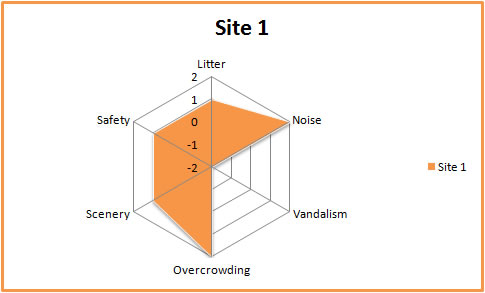
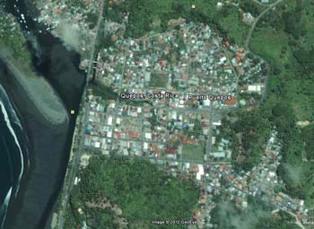
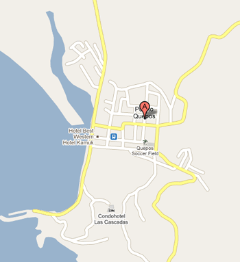
Urban Investigation
Aim: to investigate urban land use, pedestrian & traffic flows, settlement function, site, situation & communication links of Quepos, Costa Rica. |
|
Satelite image of Quepos - Google Earth |
Street Map of Quepos - Google Maps |
| Urban Study: Student booklet | |
| Questionnaire suggestions | |
IB Geography: Internal Assessment: the write up |
|
IntroductionSuggested question & hypothesis 1 Q: How do building heights vary wiith distance from the PLVI. H: There is a negative correlation between building heights & distance from the PVLI Suggested question & hypothesis 2 Q: Where is the location of Quepos' PLVI H: The PLVI is located at the highest count of pedestrian & traffic surveys. |
|
MethodologyDescribe each method you used (equipement, units of measurement, number of times repeated etc). Explain each of the methods you used (why you did it), what was the purpose. Random/ systematic sampling for questionnaire? Quantative/ qualatative data collection. |
|
Data Presentation |
|
 |
Think about how you will present your data. Choose a format that is suitable & easy to read. Do you want to have several sets of data on one chart? Could you overlay the chart onto a base map to identify the location & allow comparisons? |
 |
Make sure all charts/graphs are correctly labelled - title, axis legends, keys. Make sure any maps are either hand drawn or the source is referenced. Any charts/graphs should serve a purpose and there should be some analysis to go with them - dont just put things in to make it looker bigger, better, nicer etc. |
Isolines - These can be used to graphically represent the data collected about vehicle and pedestrian flows. Think contour lines/ layer shading & the same can be done with pedestrian & vehicle densities. Can be done onto blank base maps or using acetate. Choropleth map - to show building height in Quepos which could help identify the CBD. |
|
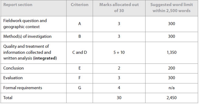
Syllabus Guidance
The IB suggested format for the investigation write up is shown in this table.
|
Breakdown of the sections |
A: Fieldwork question and geographic context
|
B Method(s) of investigation
 |
C: Quality and treatment of information collected and D: Written analysis
|
E: Conclusion
|
F: Evaluation
|
G: Formal requirements The fieldwork written report must meet the following five formal requirements of organization and presentation.
|